|
Hidden
deep in the woodlands bordering the Neches River are the last remains
of what may be the earliest fort built in East
Texas. And, perhaps, a buried treasure.
Unlike the forts Texas built to protect
settlers from Indians, Fort Teran was established by Mexico in 1831
to control the flow of smugglers and illegal immigrants into Texas.
The site was sometimes referred to as the "pass to the South."
Three important trails -- the Coushatta Trace, the Alabama
Trace and the Nacogdoches-Oroquisac road --crossed the
Neches River near where the fort was built, underscoring the significance
of the site.
The fort was named for General Manuel de Mier y Teran, commandant
general of the eastern division of Mexican Texas. Teran made an inspection
tour of Texas in 1829 and observed that
Americans were sneaking into Texas by
using the Indian trails. When he returned to Mexico, he helped draft
a law in 1830 forbidding Americans from settling in Texas.
The responsibility for enforcing the law was assigned to Teran, as
a director of colonization, and his program included the construction
of garrisons on the Neches and several other East
Texas rivers.
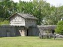
Peter Ellis Bean, a colonel in the Mexican army, was chosen to build
Fort Teran. He left Nacogdoches
for the Neches River on September 25, 1831, but work on the fort moved
slowly. When the garrison was finally finished, it had ten wooden
cabins to provide housing for Bean and his troops.
Fort Site
The site in what is now Tyler
County lies about three miles west of Rockland on the river's
south banks. The river crossing provided access across the Kisatchie
Wold, a ridge running from the Mississippi River to the Rio Grande
valley. At the time, the ridge was considered a formidable obstacle
to travel for north-south travel. In northern Tyler
County, the ridge reaches heights of 400 to 450 feet above sea
level at several peaks and has forced the Neches to run eastward along
the county's northern boundary.
Fort Teran was abandoned when the Mexican government found it was
unable to support its Texas forts adequately. In 1834, the last of
the Fort Teran troops were transferred from the river, leaving about
a dozen civilians at the site.
Samuel T. Belt opened a trading post and a post office functioned
there between 1856 and 1866. Steamboats used the river until the railroads
came to East Texas in
the 1880s.
A ferry also operated at the site. It was known at different times
as Belt's Ferry, Boone's Ferry and Duncan Ferry. When
a highway was completed east of the site in 1917, the ferry went out
of business.
Buried Treasure
Fort Teran today is both difficult to find and controversial. A logging
road leads to the site and a state historical marker erected during
the Texas Centennial
in 1936 stands on a bluff known as Money Hill.
The site was named because of rumors that Mexican troops had buried
in the river's mud a cannon filled with gold coins. Another story
claims the fortune was hidden in a cave excavated in the river banks.
A more reasonable explanation is that the cave was only a salt mine.
In recent years, there has been some speculation that the Centennial
monument may have been placed at the wrong place on the river, perhaps
even in the wrong county. Decades ago, a Lufkin historian wrote that
Fort Teran really stood on the north bank of the Neches in Angelina
County. |
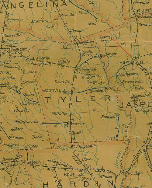 |
Tyler
County 1907 postal map showing showing Rockland near Angelina
County line
From Texas state map #2090
Courtesy
Texas General Land Office |
Forum:
I was going to recommend you add one of Bob
Bowman's write-ups to your 'Texas
Treasure Hunting' link, then realized it's probably already there.
Bob was solid...never met him unfortunately, but we are from the same
town. Have a few of his books.
My dad and I would talk about going out to the old site of Fort Teran...it's
a bend in the Neches river, and while small and flowing, with those
sandy banks, who knows how it actually flowed over 200 years ago.
Fun to think about. - Stephen Chumley, January 30, 2018 |
|
|