Where
The Maps Are "We
had to draw the line somewhere," is a phrase often heard around the Surveying
Division of the Texas General Land Office. (Usually by Doug Howard, Research
Assistant.) We decided to get the cheap joke over with so we can get on with the
serious business of reporting on this fascinating and under-appreciated bureau
of our state government. We
were once hitchhiking through West Texas, when our driver/ host swept his hand
parallel to the horizon and said: "You know, there's snakes out there that have
never seen civilization." This wise and profound observation comes to mind whenever
we think of how many people go to sleep every night, secure in knowing their neighboring
county is where it should be. Operating
on the seventh floor of the Stephen F. Austin Building, the Surveying
Division is a cartographer's dream. While the staff conducts their duties
in tiny cubicles, the map room has filing cabinets the size of Somervell
County. They must have built the building around them. These horizontal drawers
contain the hand-drawn, penciled, and pen and inked masterworks of generations
of draftsmen, cartographers and scribes. The map room is usually a beehive of
activity, if only because of the staff wanting a break from the aforementioned
cubicles.
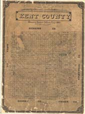
Maps and Draftsmen
Filed
alphabetically, each county has several versions of its territorial
record. Many date to when they were part of a different county, district,
or country. Many offer artistic embellishments. Oak and Laurel leaves may frame
a cartouche, or flags may drape over the county name, replete with exaggerated
serifs. The styles are so distinctive that when the map is shown, the staff member
opening the file will usually comment on the artist. "This of course, is a Bettendorf."
Of course it is. Our
guide for our last visit was Joan Kilpatrick, Program Specialist, who informed
us that many of the draftsmen in the late 19th Century were Germans
and Prussians. Not only were they precise (and punctual), but they could correct
misspellings of European names. Joan has been interested in maps since childhood,
when she would work puzzle maps until their panhandles wore down to nubs. Some
maps were drawn "in the field" by the surveyors, but clearing brush calluses the
hands and the fine detail was better left to city-dwelling, lotion-handed draftsmen.
O.
Henry; he was more than stories, embezzlement, and candy bars Besides
the maps, there are other artifacts from the 19th Century, including a
pencil sharpener that O. Henry might have used when he was employed there (1887-1891).
In O. Henry's Texas stories, his knowledge of Texas geography is immediately apparent.
It should be remembered it was he who gave us "The Cisco Kid." Two
of O. Henry's stories are set in the land office offices: Georgia's
Ruling and Bexar Script 2692. O. Henry was a draftsman and obtained
the position through his friendship with the Land Commissioner. Visit
the beautiful General Land Office Building (now the State Capitol Visitor's
Center just off the Capitol grounds) and see the room where he worked and where
most of these paper treasures were drawn. |